Walking the road wetlands drainage ditch, 2000 and 2008.
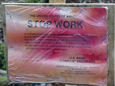
 Click on the stop work sign for pictures of the hikes we took yesterday and in 2000. Although I am still not happy about the road (and I’m *really* not happy about the paving of Five Mile by the clay banks), I have to say it was soothing to see the growth of new vegetation along the sides of the road. Proof that it might take a bit more trying to kill off Mother Nature then we all might think? In all of the slides, the photo on the left is from 2000, the one on the right is 2008 (yesterday). A few of the locations match exactly (the culvert, the stuff on the hill, Five Mile, and Ganzhorn Gash) although the angle of the photo may not. Other pairs are not matched exactly, just show similar content. When we walked this route in 2000, I had a GPS with me and was trying to match the route the GG and I had walked the previous summer. On *that* hike, this road/canal was an overgrown, buggy trail through the swamp and at one point we managed to disturb some eagles. I remember being particularly upset in 2000 (as were the others) about the almost certain loss of the eagle’s nest. But eagles still live in the vicinity of the beach and the eagle population is on the rise. So, I dunno. I didn’t take a GPS with me this time. Click here or on the pic to see the rest of the slides. When I have time, I will repost the original 2000 slideshow in its entirety with cleaned up captions. And I think I will put together a more extensive one of the 2008 hike. Happy non-Thanksgiving!
Update to clarify that the stop-work sign is from 2000. It is not current.
October 25th, 2008 at 1:02 pm
Cool comparative pictures. Extremely sad to see woods become not-woods….
October 25th, 2008 at 3:00 pm
Thank you for the slide show – sad to see the fill and pavement…. good to see that Mother Nature does heal some of her wounds… while sadly others become ugly scars…
October 25th, 2008 at 5:03 pm
Is the stop work order current or from Y2K?