Recovering from QWS, adjusting to EDT
Somebody asked me yesterday why these antique Maine Snowshoe Company bear paw snowshoes were tied to the table. It was *not* that we were worried they might disappear. The Quiet Water Symposium does not attract light-fingered folk. I doubt that the rabbit and guinea pig folks at the show that occupies an adjacent space are particularly light-fingered either. Plus I doubt that they would be all that interested in snowshoes. You have to be a pretty dedicated winter hiker to even be interested in strapping snowshoes to your boots. And, as old as these are, I doubt they are all that valuable on eBay (for example). Nope. The reason they were strapped to the table was because they wouldn’t stand up on their own.
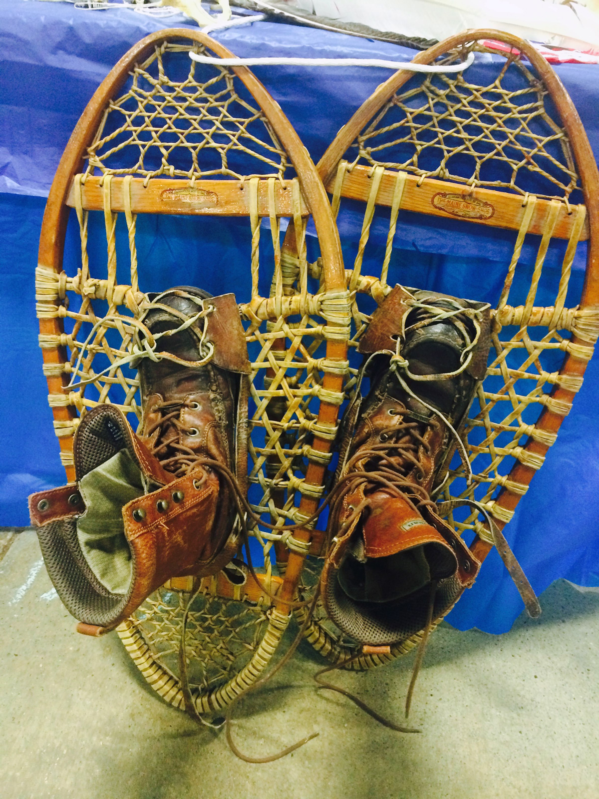
Those old bear paws belonged to my old coot and they have been around throughout my entire life. I was always intrigued by snowshoes as a child but if memory serves me accurately, my first (and only) experience with this particular pair was in my early 20s and boy were they difficult to use! I felt like my legs were about five miles apart! As I was talking to people about the bear paws, I realized that a *small* addition to our table might be a photo tribute to the guy who *owned* those snowshoes and his northwoods buddies, who hiked on or near our segment of the NCT back in the 1930s. We could hang it up on the snowshoes above the boots.
Besides the puzzle (see yesterday), most people zeroed in on our map of the NCT as it travels up through Troll-land and across the Yooperland (both of which are beloved by me, ahem).
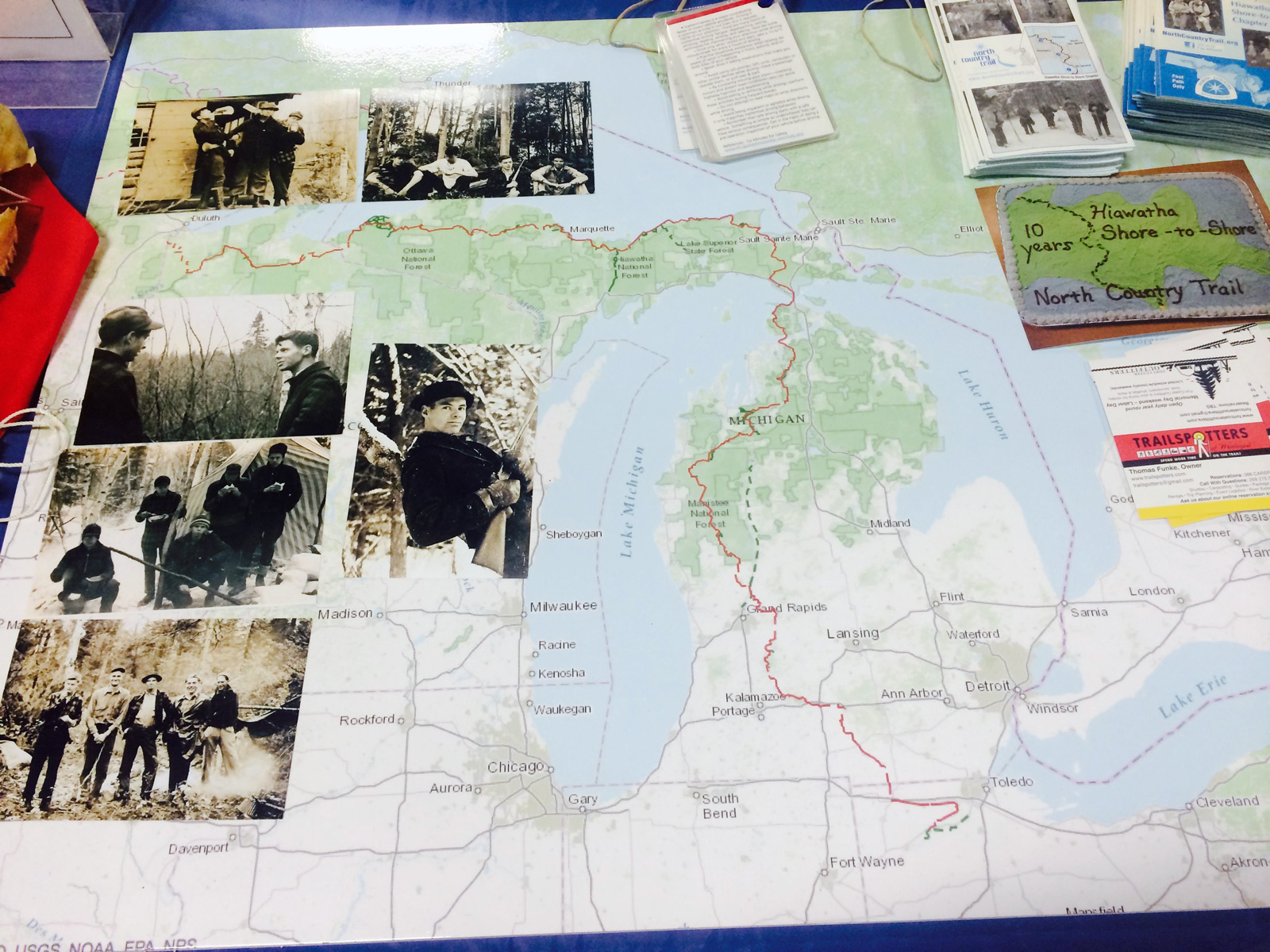
This a homemade kind of map with a GPS track (red) showing the NCT as it winds up through The Great Lake State. The GG got it blown up and printed at Staples or someplace. A stroke of genius. I could easily point out “our” section of the NCT and others. People could easily see it and point out where they live or hiked or want to hike or whatever.
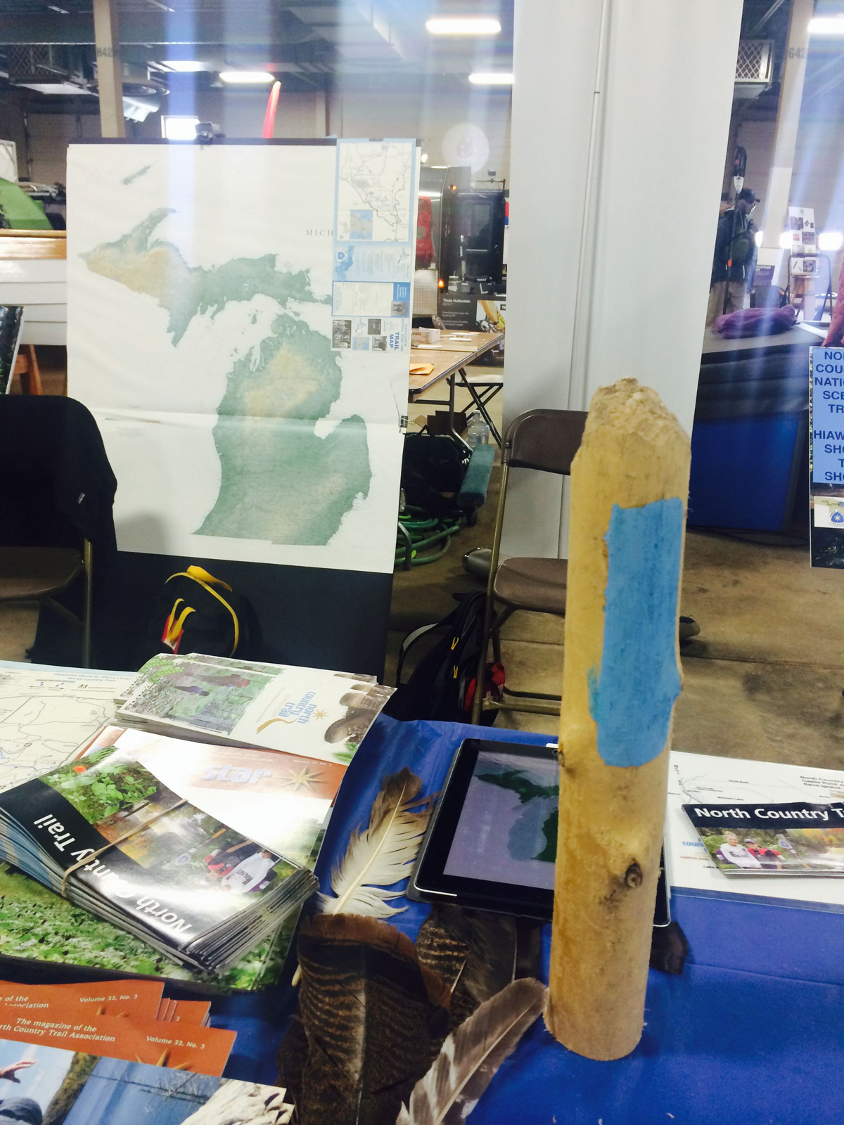
How do you find your way on the North Country Trail? You follow the blue blazes, of course. When we first started hiking Eastern UP sections of the trail back in the mid-1990s (ulp), we often struggled and a few times we got a bit lost, even with our old-school GPS. At some point after that, a bunch of Eastern UP folks met up and created the very active Hiawatha Shore-to-Shore NCT chapter. The GG eventually met up with those folks and they are our *friends* nowadays! Our segment of the trail is now very well blazed — and traveled! Bridges and boardwalks are well maintained. There is an official nationally approved paint color for those blazes and I assume the blaze on the display item below is the correct color.
Slowish day for me today but not a bad one at all. Gave myself a pass on anything besides routine housekeeping stuff like laundry and cooking, etc. Alas, I bought the GG a Go-Pro camera for xmas. After many many many issues with it, he determined that it was a blasted lemon. I bought it at REI and today, they happily exchanged it for one that works. Sheesh. I purchased that cam for him on a whim. I use one camera and that is my iPhone but heck, other folks might want more cameras and that is okay with me!
*I am interested in guinea pigs because we had a beloved GP for a long time. One who recognized my voice. So I loved walking through the Rabbit and Guinea Pig show. But I do not need a pet to take care of and I was glad to return to the QWS.
March 8th, 2015 at 10:52 pm
Those are awesome snow shoes. I tried hard to use my actual camera in CA but resorted to the iPhone on several occasions. It will be difficult to keep my photos organized if I do that. 🙂